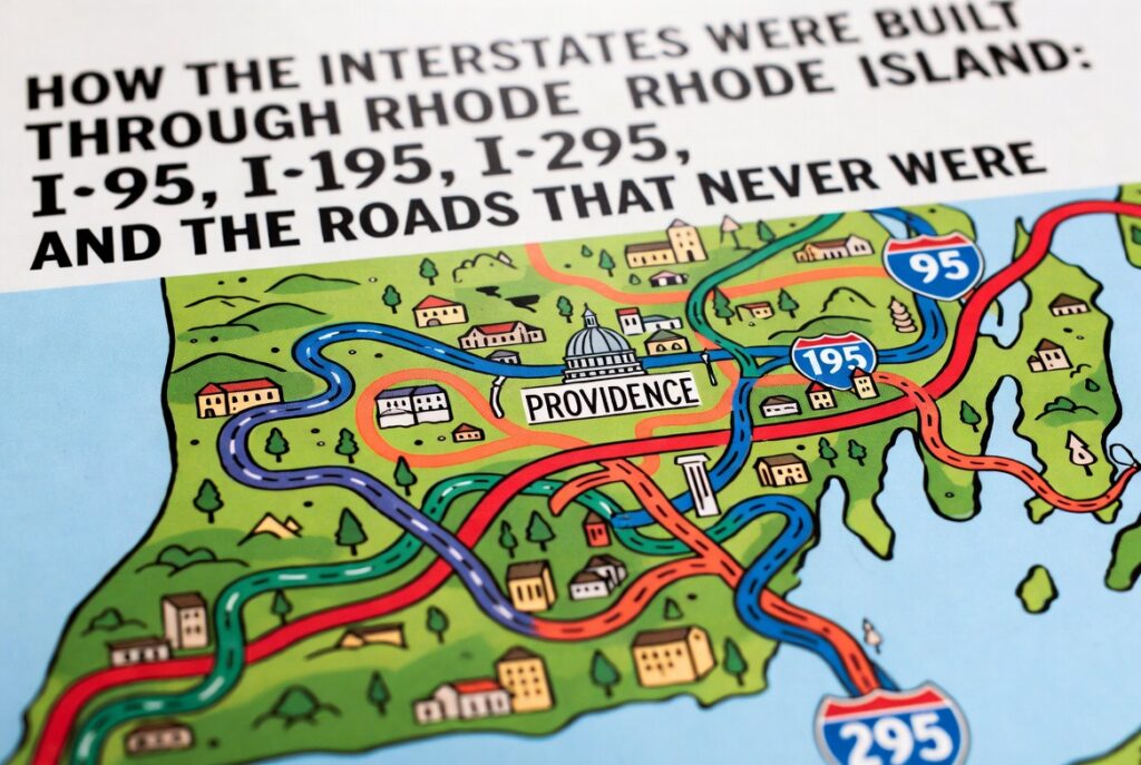
How the Interstates Were Built Through Rhode Island: I‑95, I‑195, I‑295, and the Roads That Never Were

Rhode Island, the smallest state in the United States, has a surprisingly complex history when it comes to the development of the Interstate Highway System. Despite its compact size, the state became a critical link in the Northeast Corridor, necessitating the construction of several key routes: Interstate 95, Interstate 195, and Interstate 295. Beyond these completed highways, Rhode Island also saw ambitious proposals for additional interstates and expressways that would have dramatically altered its urban landscape. This article explores the planning, construction, and impact of these highways, along with the stories of the roads that were envisioned but never built.
The Origins of the Interstate System in Rhode Island
In 1956, the Federal-Aid Highway Act authorized the creation of the Interstate Highway System, launching the largest infrastructure project in U.S. history. For Rhode Island, this legislation was transformative. Federal funding would cover 90% of the construction costs, with the state responsible for the remaining 10%. The Rhode Island Department of Public Works, led during the early years by Director John J. Moran, collaborated with federal highway officials to determine the most strategic routes through the state. Given Rhode Island’s geographic location between Boston and New York City, the corridor chosen for Interstate 95 was a natural priority.
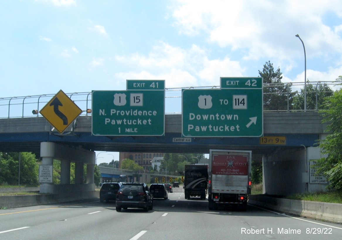
Before the interstates, Rhode Island relied heavily on U.S. Routes 1, 6, and 44 to handle regional and interstate traffic. These roadways were often congested, passing directly through busy towns and cities such as Providence, Warwick, and Pawtucket. The goal of the new system was to alleviate traffic bottlenecks, improve safety, and foster economic growth by connecting Rhode Island more efficiently to the rest of New England.
Constructing Interstate 95
Interstate 95 is the backbone of Rhode Island’s highway network, entering the state from Connecticut in Westerly and continuing northeast through the urban core of Providence before crossing into Massachusetts in Pawtucket. Construction began in phases in the late 1950s and continued into the early 1970s, reflecting the challenges of building a modern highway through densely populated areas.
The first major segment to open was the stretch from the Connecticut border to Warwick in the early 1960s. This section was comparatively straightforward to build, as it passed through less developed areas with fewer displacement concerns. As the highway approached Providence, however, the construction became far more complicated and controversial.
In Providence, the routing of I‑95 required the clearance of entire city blocks, displacing thousands of residents and businesses. The construction of the highway through the West End and South Providence in the late 1960s was a pivotal moment, reshaping the city’s neighborhoods. The famous Providence Viaduct, which carries I‑95 over the Woonasquatucket River and major rail lines, became a critical engineering achievement. After years of phased development, the entire Rhode Island portion of I‑95 was completed by 1972.
The Development of Interstate 195
Interstate 195 serves as a vital link between Providence and southeastern Massachusetts, ultimately connecting to Cape Cod via I‑495 and Route 25. Planning for I‑195 began as part of the original interstate blueprint, with the intention of providing a high-speed route to replace the heavily traveled U.S. Route 6 corridor through East Providence.
Construction of I‑195 began in the early 1960s, with segments opening gradually through the decade. One of the most significant challenges was the completion of the Washington Bridge expansion over the Seekonk River, which had to be widened to accommodate the interstate. The final configurations in Providence required the controversial construction of the I‑195/I‑95 interchange—often referred to as the “I‑195 East-West Split”—which became notorious for its sharp curves and congestion.
By 1968, I‑195 was fully operational through Rhode Island. In 2010, decades after its initial completion, the highway would undergo a major realignment known as the Iway Project, relocating portions of the interstate to improve traffic safety and open up land for redevelopment in Providence’s Jewelry District.
Interstate 295: The Bypass Around Providence
Interstate 295, conceived as a beltway to relieve congestion on I‑95, forms a partial circumferential route west of Providence. Planning for the bypass began in the late 1950s, and construction proceeded through the 1960s and 1970s. The highway arcs through the suburban communities of Johnston, Cranston, Warwick, and Cumberland, linking I‑95 in Warwick to I‑95 again in Attleboro, Massachusetts.

The strategic purpose of I‑295 was to allow long-distance travelers—particularly freight traffic from New York to Boston—to avoid the urban congestion of Providence. Its development also encouraged suburban growth, facilitating the expansion of neighborhoods and industrial parks in western Rhode Island. The highway was largely complete by 1975, and its interchanges with routes such as U.S. 6 and Route 37 became critical nodes in the state’s transportation network.
Proposed and Unfinished Interstates
Not every interstate or expressway envisioned for Rhode Island came to fruition. During the height of the freeway planning era, the state considered several ambitious projects that were either canceled due to public opposition, cost concerns, or shifting transportation priorities.
- I‑84 Extension to Providence: A proposed connection from the existing I‑84 in Connecticut to I‑95 near Providence would have created a direct Hartford-Providence route. Environmental concerns and opposition from rural communities in western Rhode Island led to the project’s cancellation by the late 1970s.
- Route 37 East-West Corridor: While Route 37 exists as a short expressway in Cranston and Warwick, early plans envisioned it extending east to I‑195 and west to Connecticut. The full project never materialized, leaving the existing road as a fragment of its original concept.
- I‑895 / East Bay Bypass: In the 1960s, planners considered a new interstate that would have crossed the Providence River and run through Barrington and Warren before reconnecting with I‑195 in Massachusetts. Fierce local opposition and environmental challenges prevented its completion.
These canceled projects reflect a broader trend of the 1970s and 1980s, when the nationwide freeway revolt reshaped urban planning. Rhode Island’s small size and dense settlements made large highway projects particularly disruptive, ultimately limiting the number of interstates built in the state.
Impact on Rhode Island’s Cities and Communities
The construction of the interstate system had profound effects on Rhode Island’s social and economic fabric. In Providence, the routing of I‑95 through established neighborhoods accelerated population shifts, contributing to suburbanization and the decline of certain urban areas. Entire streets were eliminated, and the visual and acoustic presence of the highway created lasting divisions between neighborhoods.
Conversely, the interstates spurred economic growth by improving access to industrial zones, ports, and airports. Warwick, for example, benefited from its proximity to both I‑95 and I‑295, which supported the development of T.F. Green Airport as a regional hub. Suburban retail centers and business parks flourished along the new corridors, reshaping the state’s economic geography.
Conclusion
Rhode Island’s interstate highways are a testament to both the ambition and the controversy of mid‑20th century infrastructure planning. I‑95, I‑195, and I‑295 transformed mobility in the state, linking its cities to the broader Northeast Corridor while simultaneously reshaping neighborhoods and landscapes. The unbuilt interstates serve as reminders of the limits of highway expansion in a densely settled state, where the cost to communities often outweighed the perceived benefits. Today, the legacy of these projects continues to influence Rhode Island’s development, traffic patterns, and urban planning decisions.